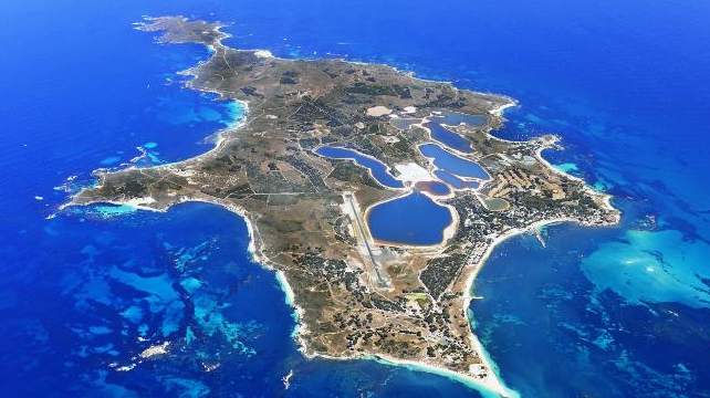
Our client: Rottnest Island Authority.
RIA is the statutory body that controls and manages Rottnest Island, a Class A reserve of environmental and cultural significance.
Strict guidelines apply to all subsurface works on the island. The island, with its reputation for pristine beaches and world-class snorkelling and swimming, is a primary draw for tourism to WA and the Authority reports directly to the Minister for Tourism.
Description of the project:
- Subtera was contracted to conduct a topographic survey for the areas on Rottnest Island where a proposed new pipeline was to be laid.
- Subsurface mapping utilising ground penetrating radar (GPR) was also required to map all existing services within the defined area to enable engineers and Rottnest Island Authority to best plan out the new works.
The proposed pipeline would connect Waste Water Treatment Plant (WWTP) and Tank 6, and would provide essential irrigation for the golf course in the same area.
Total length of proposed pipeline:
- 1.2 KM from WWTP to Tank 6
- 200m from WWTP and golf course irrigation system
Technical specifications/considerations:
- Class A nature reserve status required all works to be completed in accordance with the RIA environmental policy
- Site to be investigated includes existing access roads, bike paths and sandy tracks that are in use daily
Our approach:
Ground penetrating radar services are commonly used for pipe locating for companies who plan to excavate or develop a site. Effective subsurface mapping using ground penetrating radar can prevent costly mistakes or damages that may result from digging into the unknown.
It is not uncommon for GPR to uncover objects that are unusual or unexpected. But because of the way Rottnest Island has grown and developed over the years, this project presented additional significant challenges that required the best innovation and problem solving abilities of our highly skilled team.
Challenge: Area of significant cultural impact
Between 1838 and 1903 Rottnest Island was used as a prison for Aboriginal male prisoners from all over Western Australia. Many of these prisoners died and were buried on the island.
Today the island is an important cultural area for the indigenous people and the Authority has strict guidelines as to where workers or contractors can and cannot dig.
Solution:
Rather than excavate the underground services at the point of mapping for identification purposes the Subtera team followed the pipework back to source using GPR. Once at source, our teams were able to accurately identify the underground services without having to excavate.
Challenge: No accurate overview of subsurface works currently in use or previously disconnected
Our challenge was to accurately map an intricate web of underground services laid throughout the history of settlement on the island. This would include subsurface works from its time as a:
- Maritime base for pilot services and lighthouses
- Colonial settlement
- Penal settlement
- Military base during WWI and WWII
- Tourist destination
No comprehensive record exists for the underground services carried out throughout the many incarnations of the island.
This has resulted in a complicated web of pipe work and cabling below the surface, some of which is current and in use, others of which are disconnected or no longer required. Underground services located by ground penetrating radar during this project include potable water, fibre optic cables, pumped sewer mains and electrical cabling.
Solution:
Although our client only required data on active subsurface works in the area, by using GPR to accurately map all works, whether functioning or not, we were able to provide our client with the most comprehensive overview of the area in which they would be laying new pipe lines. This ensured that they could plan for the most direct and cost effective route for new underground services without experiencing many unforseen delays navigating around disconnected lines they were not aware of. Ultimately the client will experience a saving of $4 for every $1 spent with Subtera by having an accurate representation of the subsurface utilities.
Challenge: Limited vehicle access
Working on any island poses difficulty with the transportation of equipment to the location. However, Rottnest Island posed additional restrictions, as much of the area in which we were working was inaccessible to vehicles.
Solution:
Understanding the limitations for this site we carefully selected and condensed our GPR, Electromagnetic Locating Devices and Survey Equipment to fit in just one vehicle. This was then transported across to Rottnest on the regular industrial barge that services the island.
Once on the island our team worked within the restrictions presented, regularly walking 30km a day transporting equipment by hand.
Challenge: Presenting the findings
The information we provided would inform the decisions and planning of the engineers contracted to complete the work. It was clear to us that the engineers would greatly benefit if the results were presented in such a way that would enhance their role in the development of the project.
Solution:
Our teams liaised with the engineers to develop a more in depth understanding of what they would require from our GPR data to be able to present the best solution for our client. It became evident that, although RIA only specified a limited area for our survey, it was necessary to expand the scope to provide additional data so that a more considered decision could be made as to the final location of the proposed works.
We created a specially formatted 3D model that the engineers could import directly into their planning thus enabling them to deliver a more comprehensive, considered solution to our client for the proposed works.
Result:
Despite the additional challenges that this GPR project presented, many of which added significant time and complication to the project. However we completed all underground locating services on time and within the set budget.
Testimonial:
“Subtera have a flexible attitude towards services investigations and proved to be creative problem solvers during site works. They demonstrated high levels of commitment and professionalism as they sought out viable solutions to some of the unique challenges posed by working on Rottnest Island. Their timely response, collaborative attitude and quality documentation have allowed the RIA to issue their deliverables directly to the Contractor for purposes of design. We are happy with the work that they have completed for us and would recommend them to other companies seeking subsurface mapping and/or topographical surveys.”
Aaron McCreath, Project Manager, Rottnest Island Authority
Recent Comments